- About
- Visiting
- What’s On
- Venue hire
- Catalogues
- Collections
- 101 Treasures of Chetham’s
- Digital Resources
- The Flowers of Histories
- A Book of Hours from France
- The Manchester Scrapbook
- Thomas Barritt of Manchester
- Art Treasures Examiner of 1857
- Manchester Association for Constitutional Order
- The North Western Museum of Science and Industry: Some Reminiscences by Richard Hills
- Criminal Manchester
- The Cup of Destiny
- Athenaeum Souvenir
- Middle English Manuscripts
- Manchester and Liverpool of Today
- Hollingworth’s Mancuniensis
- Memoir of Cecil Wray
- William Seward’s Diary
- The Anti-Monopolist
- Fishwick’s History of Rochdale
- Knyvett’s Defence of this Realm
- Tractatus de Nigromantia
- Axon Ballads
- Printed Books & Ephemera
- Archives & Manuscripts
- Prints and Photographs
- Blog
- Support us
De Laet’s Novus Orbis
Joannes de Laet, Novus Orbis, seu Descriptionis Indiae Occidentalis Libri XVIII
Published in Leiden by Elzevier, 1633
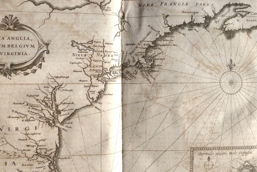
One of the most important seventeenth-century New World histories, this first Latin edition is a cornucopia of early knowledge of the Americas and is the first to use the names Manhattan, New Amsterdam (for New York), and Massachusetts.
It was compiled by Joannes de Laet (1581-1649), one of the founding directors of the Dutch West India Company and a great scholar who published widely on a number of subjects as well as his specialisms of geography and the New World. The book includes fourteen double-page maps by Hessel Gerritsz, a Dutch engraver who was appointed official cartographer of the Dutch East India Company, and has an engraved title page with an elaborate border as well as sixty-eight woodcuts throughout the text.
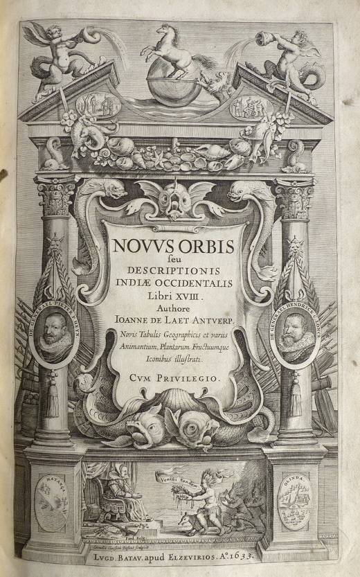
De Laet’s work has been described as ‘arguably the finest description of the Americas published in the seventeenth century’ (Burden), and was preceded by two editions in Dutch, the first of which was published in 1625. Pierre François Xavier de Charlevoix, writing in the eighteenth century, noted that the work as a whole ‘is full of the most excellent and curious details of the natural history, and the character, manners, and customs of the American aborigines, derived from the reports of the European mission establishments in America’.
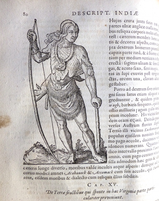
While most of the illustrations are of biological or botanical specimens, a number are of individuals or groups. This image from the section on lands in Virginia shows Chief Powhatan, the father of Pocahontas, who later converted to Christianity, married John Rolfe and became known by her English name of Rebecca.
The maps are some of the very best to appear up to that time, and their quality can be gauged from the fact that they served as a prototype for the mapping of America, with a number of them being reused in various later seventeenth-century atlases. De Laet continued to add to and improve the work throughout his lifetime: this edition contains fourteen maps as opposed to the ten in the 1625 edition, and the text has been considerably expanded.
