- About
- Visiting
- What’s On
- Venue hire
- Catalogues
- Collections
- 101 Treasures of Chetham’s
- Digital Resources
- The Flowers of Histories
- A Book of Hours from France
- The Manchester Scrapbook
- Thomas Barritt of Manchester
- Art Treasures Examiner of 1857
- Manchester Association for Constitutional Order
- The North Western Museum of Science and Industry: Some Reminiscences by Richard Hills
- Criminal Manchester
- The Cup of Destiny
- Athenaeum Souvenir
- Middle English Manuscripts
- Manchester and Liverpool of Today
- Hollingworth’s Mancuniensis
- Memoir of Cecil Wray
- William Seward’s Diary
- The Anti-Monopolist
- Fishwick’s History of Rochdale
- Knyvett’s Defence of this Realm
- Tractatus de Nigromantia
- Axon Ballads
- Printed Books & Ephemera
- Archives & Manuscripts
- Prints and Photographs
- Blog
- Support us
Saxton’s Atlas of England and Wales
Sponsored by T. Seckford. Printed in London in 1579
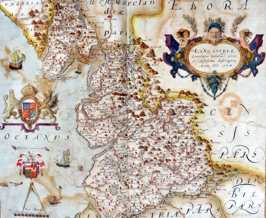
Saxton’s was the first national atlas of any country. It contains thirty-five coloured maps, each bearing the arms of Elizabeth I and Thomas Seckford, Master of the Queen’s Requests and Saxton’s patron.
The county maps show a number of geographical features. Hills and mountains are pictorially defined – the aim being to convey an impression of topography rather than to provide precise information on the location and altitude of particular summits. A variety of representation is used to show buildings and settlements. The small symbol of a building surrounded by a spire defines a village while more important towns are often represented by groups of buildings sometimes with a church-like edifice in their midst.
All of the engravers of Saxton’s maps were of Dutch or Flemish origin. The map of Lancashire was drawn in 1577 and engraved by Remigius Hogenberg. The atlas was acquired by the Library around the mid-eighteenth century. It is not known whether it was bought or given.
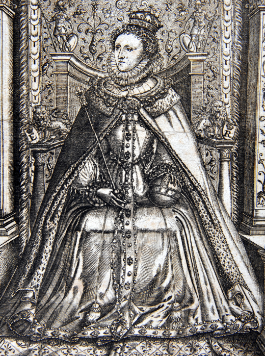
Portrait of Queen Elizabeth I from the frontispiece.
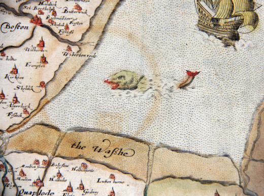
Part of the map of East Anglia showing the Wash with dangerous-looking inhabitants.