- About
- Visiting
- What’s On
- Venue hire
- Catalogues
- Collections
- Belle Vue – search archives catalogue
- Digital Resources
- Art Treasures Examiner of 1857
- Manchester Association for Constitutional Order
- The North Western Museum of Science and Industry: Some Reminiscences by Richard Hills
- Criminal Manchester
- The Cup of Destiny
- Athenaeum Souvenir
- Middle English Manuscripts
- Manchester and Liverpool of Today
- Hollingworth’s Mancuniensis
- Memoir of Cecil Wray
- William Seward’s Diary
- The Anti-Monopolist
- Fishwick’s History of Rochdale
- Knyvett’s Defence of this Realm
- Tractatus de Nigromantia
- Axon Ballads
- Prints and Photographs
- 101 Treasures of Chetham’s
- Printed Books & Ephemera
- Archives & Manuscripts
- Blog
- Support us
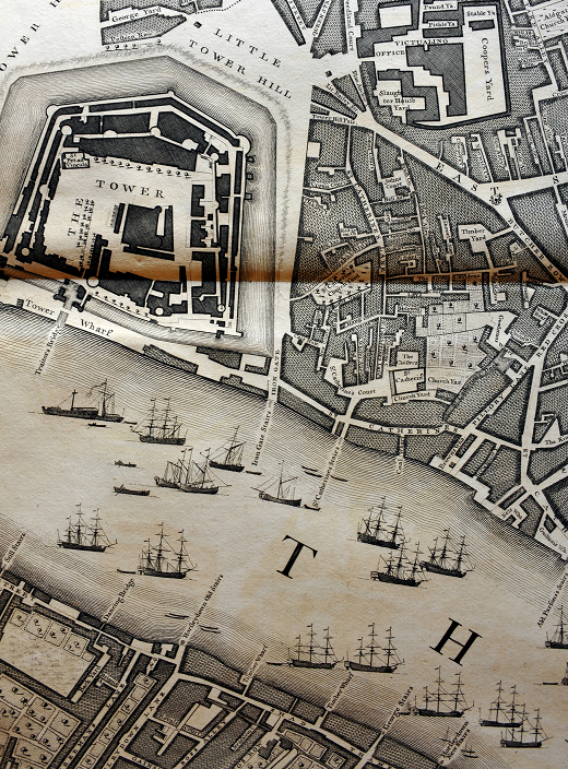
Rocque’s Map of London
John Rocque, A plan of the cities of London and Westminster, and borough of Southwark, with the contiguous buildings; from an actual survey, taken by John Rocque, land-surveyor, and engraved by John Pine, Bluemantle.
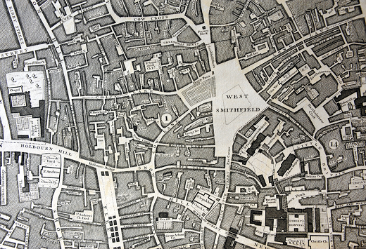
Printed in London, 1746
It may seem odd for a library which specialises in the history of Manchester to single out a map of London as a treasure, but John Rocque’s 1746 large-scale plan of London is both a magnificent example of cartography and an indispensable reference tool for historians: one of the greatest and most handsome plans of any city.
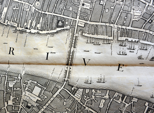
John Rocque (properly Jean) was a French Huguenot émigré whose family settled in London in 1709. He worked initially as an estate surveyor with his brother Bartholomew, who ran a market garden in Fulham, and the two produced a number of plans of fashionable London estates. In 1737 he embarked on the ambitious project of surveying the whole of London at a scale of 26 inches to the mile, an undertaking which would take him more than nine years to complete.
The map was squared and numbered for reference, with scale bars in several measures, and was issued with an alphabetical index to streets and thoroughfares. Rocque produced an elaborate system of hatching and broken lines to distinguish buildings, market gardens, fields and woods and the map was engraved by John Pine, who described himself as Bluemantel Pursuivant at Arms and Engraver of Seals to His Majesty.
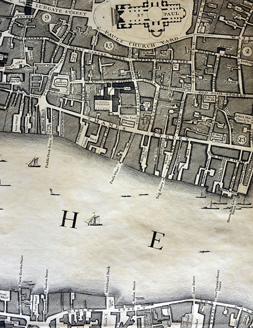
The Library holds a copy of Rocque’s 1740 proposal for engraving and printing the map as well as the 1746 plan. Each sheet measures approximately 27 x 19 inches (77 x 57 cm.) The twenty-four sheets are arranged in three rows of eight, and are referenced A-H horizontally and 1-3 vertically.
The map proved popular and Rocque produced several later editions during his lifetime, in addition to several smaller plans of the London area. But the making and publishing of maps did not bring him material rewards: despite the grand title of ‘Topographer to His Majesty George III’, at his death in 1762 Rocque left his nephews just one shilling each.